
Moorhead ZIP Delivery Areas
USPS is the operational authority for a Moorhead ZIP code. The values below appear in official and state institutional address material, but they are delivery designations rather than neighborhood boundaries or resident counts. The first check is always the full street or mailing address. The USPS ZIP Code Lookup standardizes that address and can show the associated delivery ZIP.
| ZIP | Areas Covered | Post Office | Notes |
|---|---|---|---|
| 56560 | Moorhead standard street-delivery addresses | Moorhead Post Office | Confirm the precise USPS address. Mailing city and city limits are not the same thing. |
| 56561 | Moorhead PO Box or special-delivery use | Moorhead Post Office | Do not treat it as ordinary street-residence geography. |
| 56562 | Institutional or organization-associated Moorhead addresses | Specific station not identified in the research | Verify the individual address with USPS. |
| 56563 | Institutional or organization-associated Moorhead addresses | Specific station not identified in the research | Verify the individual address with USPS. |
The Moorhead ZIP code directory does not supply an official current ZIP boundary map, a per-ZIP population total, or a registration total, because the research found none published by an official source. That absence matters. A ZIP is helpful for matching a mailing address, but it is not a stand-alone map of the city or a list of people.
USPS and Moorhead ZIP Checks
Use USPS before comparing records that spell a street, direction, apartment, or postal suffix differently. The lookup offers Find by Address, Find by City and State, and Find Cities by ZIP. Its address result normalizes delivery information. USPS specifically cautions that the result does not confirm a person or a company at that address.
The USPS ZIP Code Lookup is the source shown below.
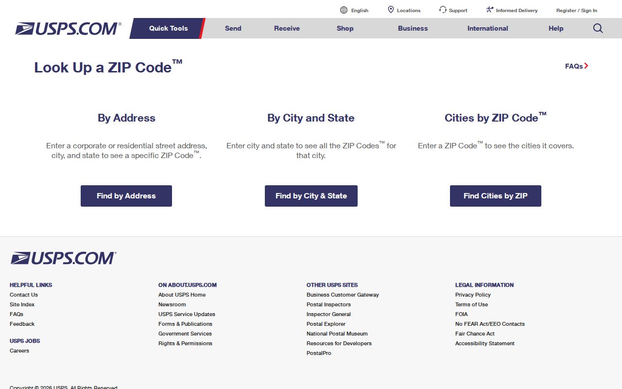
The address-first form is useful because it separates a verified delivery format from later parcel, archive, or voter-registration research.
For counter service, the Moorhead Post Office is at 119 5th St S, Moorhead, MN 56560-9998, and its telephone number is 218-422-2000. Retail hours listed in the research are weekdays from 8:00 a.m. to 5:30 p.m. and Saturday from 9:00 a.m. to 11:00 a.m. PO Box access is listed as available around the clock.
USPS Fields for Moorhead ZIP
When the known information is a street address, the address form is the most direct route. Company is optional. The other supplied elements make it possible for USPS to return a standardized mailing result. Enter a unit when one is part of the address, then preserve the returned form before searching a different public system.
| Lookup element | Required | Use in the result |
|---|---|---|
| Company | No | Optional delivery-line information, not confirmation of an organization. |
| Street Address | Yes for address lookup | Identifies the delivery location to standardize. |
| City | Yes for address lookup | Pairs the street with its city mailing form. |
| State | Yes for address lookup | Limits the match to Minnesota. |
Find by City and State is useful for checking the ZIP values USPS associates with a city name. Find Cities by ZIP works in the other direction. Neither mode establishes a city-limit line, parcel ownership, or a current occupant.
Moorhead ZIP Search Workflow
A full delivery address produces a safer record trail than starting with a bare ZIP. The sequence below keeps mailing geography separate from property records and from historic research. Once a ZIP has narrowed the area, the address-level route belongs on the Moorhead street address directory.
- Enter the full known address in USPS and keep the standardized city, state, ZIP, and unit form.
- Check the modern site address in the city or Clay County property system, using the street address or parcel ID rather than a ZIP-only search.
- Inspect Clay GIS address attributes when a ZIP, ZIP+4, address status, effective date, retired date, or address authority is material to the question.
- Use the historical archive only after identifying the address period, since older directories predate the modern ZIP system.
Note: A delivery ZIP is an address key, not proof that a person is connected to a parcel or mailing line.
MNVotes and Moorhead ZIP Searches
MNVotes permits a ZIP or county choice, but it is not a ZIP-wide directory. The state form validates a supplied registration combination. It asks for identity and address details together, so a ZIP alone cannot return a roster of names or addresses.
| MNVotes field | Role | Format or option |
|---|---|---|
| First and last name | Identifies the voter record to validate | Both supplied on the form |
| Date of birth | Distinguishes the registration combination | Month, day, and year |
| ZIP or county | Sets the geographic lookup path | User selects one approach |
| City or township | Supplies local address context | Address entry |
| House number and street | Matches the supplied address | Required address details |
| Apartment or unit | Refines a multi-unit address | Optional checkbox and field |
Registration data can also have lawful safety protections. A missing result should not be treated as proof that a person has never lived at an address or that a ZIP is wrong.
Clay QuickSearch Without ZIP
Clay QuickSearch accepts Parcel ID or Address. The observed public form does not expose a ZIP filter. That makes it useful after USPS has standardized a street address, not as a tool for collecting every parcel associated with a ZIP.
Moorhead Property Information did not expose its search fields during the research without its acceptance interaction. For systematic ZIP work, Clay's address-point schema is the stronger documented option because it can hold ZIP, ZIP+4, status, effective and retired dates, and address authority. City or Clay GIS staff can explain the available layer, and a request to the City Clerk or County Auditor can ask for an existing lawful aggregate rather than a newly created list.
Moorhead ZIP Terms Defined
Postal terms can look more precise than they are. They describe how mail moves or is labeled, while a parcel system and a local address system serve different purposes. Keeping the terms separate prevents a PO Box or an institutional delivery code from being mistaken for a street-based location.
- ZIP
- The five-digit USPS delivery code associated with a mailing address or service arrangement.
- ZIP+4
- An added four digits that refine a delivery segment beyond the basic ZIP. Clay address points can carry this field.
- PO Box ZIP
- A ZIP used for box or special delivery service. It does not by itself describe an ordinary street address.
- Carrier route
- A postal delivery grouping. It can assist mail operations, but it is not a city boundary or a household list.
USPS, not a local directory, is the source to use when the question is whether a particular address has a particular ZIP or ZIP+4.
Moorhead ZIP Code City Limits
A Moorhead mailing label should not be used as a shortcut for city jurisdiction. Clay's 911 addressing system took effect in October 1998. Incorporated places, including Moorhead, assign their own addresses while following county standards, and Clay GIS assigns rural addresses. Highway 10 divides north and south address directions, while the Red River divides east and west in downtown Moorhead.
Those addressing rules help explain why the parcel record, municipal jurisdiction, and postal address need separate checks. A city record may be held by Moorhead, while the Recorder and county GIS cover Clay County more broadly. Before requesting data, confirm the site address, the parcel's jurisdiction, and the mailing format rather than assuming all three boundaries match.
Clay's standards distinguish the recipient, delivery line, and last line. For a present address, retain the number, street name and type, direction, and unit when supplied. Older sources may instead use abbreviations such as “cor,” “n of,” “h,” or “r” and describe a cross-street relationship. That older description needs to be translated through a plat, directory, or map before it can be compared with a current delivery form.
Moorhead's 56547 Postal Clue
Historic USPS material labels 56560 through 56563 as Moorhead destinations. A 2016 Postal Bulletin notice says 56547 changed from a Moorhead 56560 association to Glyndon. That is a useful history marker for an older mailing reference, but it does not establish present ZIP boundaries or a current population count.
For an older address, do not carry a modern ZIP backward without checking its date. HCSCC directories, plats, and map material can help place an older street description in Moorhead, but those records predate modern ZIP geography. Use them as an address bridge, then return to USPS for the present delivery form.
Moorhead ZIP Code Research Limits
The Moorhead ZIP code directory has a clear boundary: no official current boundary or per-ZIP population table was located in the research. USPS can verify delivery information. Clay QuickSearch can find a parcel by address or ID. MNVotes can validate a supplied registration combination. None of those services creates an open ZIP-wide roll of people.
When an existing city or county dataset is needed, use the City Clerk public-data request route or County Auditor route and identify the fields, date range, geography, and preferred format. For a historical address that has no modern ZIP context, HCSCC directories, tax rolls, and maps are the documented fallback. Ask for a record that exists, not for a newly assembled dossier.
Moorhead's public-data route follows Minnesota's Government Data Practices Act. Inspection is free, while copies may carry actual or reasonable costs. A government office responds to an identified record request, but it does not have to create a new dataset or reformat one it does not maintain. That rule is especially relevant when the question asks for a ZIP-level comparison that no portal displays.
Personal-use boundary. Address research is appropriate for lawful personal, family-history, civic, or property questions. Do not use a ZIP or address trail to stalk, harass, intimidate, or monitor another person.