
Trace a Moorhead Street Directory by Address
A street search begins with an address, not a name. Use the street number to find the physical parcel, then keep the parcel number with every later result. That order separates a site address, where land sits, from a tax mailing address, where the bill is sent. It also keeps a recorded party or directory listing from being mistaken for proof that every person at the address lives there now.
For a long street, repeat the same process one parcel at a time. A map can put the parcels in sequence, but it is not a roster. Property and Recorder records can document ownership and legal interests. Minnesota's voter tools have narrower rules: the public status lookup validates a supplied combination of name, date of birth, and address instead of producing an open street list.
- Enter an address in the city or county property source that serves that parcel.
- Copy the parcel ID, site address, and abbreviated legal description into research notes.
- Use the GIS map to move along the street and identify the next parcel without guessing at a boundary.
- Open the Recorder index with the parcel ID or legal description when a deed, plat, or dated transfer matters.
- Use permit, code, or archival sources only for the narrower address question each one can answer.
- For historic households, pair an old directory with tax, census, map, or deed evidence from the same period.
Choose the Right Moorhead Street Record First
Jurisdiction comes before a property search. Moorhead Assessing and the city's Property Information system maintain city parcels. Clay County Assessor and GIS maintain parcels outside the city limits. A result that looks incomplete may simply have been started in the wrong system, so check the city boundary before treating a no-result as a missing address.
The Moorhead Property Information portal supplies valuation, land and building details, sales, special assessments, permit context, tax estimates, and map links for city parcels. Clay QuickSearch is the county route for an address or parcel ID outside city limits. The Clay Assessor can also be reached at 218-299-5017. For records not available in a portal, request existing city data through the City Clerk under the Minnesota Government Data Practices Act rather than asking staff to create a new street list.
Read a Moorhead Street Address in Clay QuickSearch
Clay County QuickSearch has separate text fields for Parcel ID and Address. An address search can be the practical entry point, while a parcel search is useful after the map has identified a number. The observed form shows a parcel format such as 58.055.0830 and an address such as 807 11 ST N. Those examples describe the form, not a current household.
| QuickSearch item | How it helps address work |
|---|---|
| Parcel ID or Address | Alternative starting fields with separate search actions. |
| Taxpayer and mailing fields | Identify the assessment contact, which can differ from the property site. |
| Site address and S/T/R | Connect the street location to the legal land reference. |
| Abbreviated legal description and deeded acres | Supply the wording needed for Recorder and map follow-up. |
| Reports, assessment, tax, and map links | Move from the summary record to a more specific property question. |
A taxpayer name or mailing address is an assessment field, not a promise of occupancy. Estates, trusts, businesses, and out-of-town owners can all appear there. A homestead classification is useful owner-occupancy evidence, but it is not conclusive proof that a particular person is currently present.
Map Moorhead Streets One Parcel at a Time
The Moorhead Interactive GIS Maps entry point leads to city map tools with property, aerial, and flood context. Its Parcel Annotation service can show address labels, unit numbers, parcel IDs, line dimensions, block and lot numbers, and street names. Use those labels to establish sequence, then return to the applicable property source for the record details.
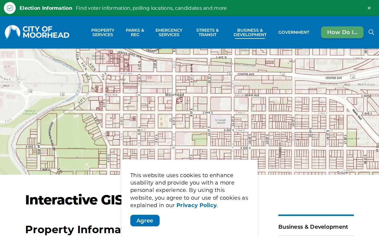
The map is a locator, not a legal survey or ownership finding. Clay GIS also offers TaxParcels, Subdivisions_and_Lots, CadastralReference, and GeopoliticalAreas layers. Clay says its parcel lines derive from Recorder legal descriptions and are approximate, about plus or minus two feet in urban areas and plus or minus forty feet in rural areas. When an edge matters, the recorded legal description and plat control.
Address Rules Behind Moorhead Streets
Clay's 911 addressing standards help decode a street name before a search begins. North-south routes are Streets and east-west routes are Avenues. Highway 10 divides north from south, while the Red River through downtown divides east from west. West-side routes use NW or SW, and incorporated cities assign their own addresses within those standards.
Those directional details prevent a common false match. The county system became effective in October 1998, while Moorhead did not have house numbering until 1902. An older directory may describe a home by a cross street and distance, rather than by a modern number. Compare the old description with a plat, a Sanborn map, or a nearby directory entry before carrying it forward.
Insider tip. A Moorhead parcel beginning with 58 is a useful Laredo search clue, but retain the full parcel ID and verify every match against the city or county property record.
A Moorhead Street Name Is Not a Legal Description
A street address helps locate a Moorhead property, but the legal description identifies the land in the record system. Depending on the parcel, that wording may use a lot and block in a named subdivision, a section-township-range reference, or another formal description. QuickSearch supplies an abbreviated form, while Recorder instruments and plats provide the fuller land reference needed for a careful boundary or deed check.
This distinction matters when addresses change, a corner parcel meets two streets, or a condominium unit has its own legal identity. Copy the address and legal description together. If later results use different street labels but the same parcel or lot-and-block wording, the files may concern the same Moorhead land. If the legal description differs, pause before treating the results as one property.
Moorhead Street Directory Records by Address
Each record set answers a different question. Start with the source that identifies the parcel, then use the address and legal description to link the next source. The table separates evidence of land, a recorded transaction, a city event, and a historical listing so that one label is not stretched beyond what it proves.
| Address-keyed record | Local keeper | Useful result | Access path |
|---|---|---|---|
| Assessment and parcel card | Moorhead Assessing or Clay Assessor | Taxpayer or owner field, mailing and site address, value, classification | Property portal, GIS, office, or data request |
| GIS parcel map | Moorhead GIS or Clay GIS | Parcel geometry, ID, block or lot context, map layers | City or county map viewer |
| Deed, lien, mortgage, or plat | Clay County Recorder | Parties, recording date, legal description, document image | Laredo/Tapestry, counter inspection, or copies |
| Voter registration | Minnesota Secretary of State | Validation of a supplied registration combination | MNVotes, subject to its required fields and limits |
| Permit or code event | Moorhead Building Codes or Neighborhood Services | Documented work, inspection, or address-related city event | Property Information, department contact, or records request |
The parcel ID is the strongest bridge across the assessment roll, map, and Recorder index. The street name is mainly a locating aid. If an ownership name is important, preserve the exact record role, date, parcel ID, and source rather than reducing the result to a claim that the person lives on the street.
- Parcel
- A defined piece of land used in assessment and mapping systems. The parcel ID links the map to the assessment record.
- Situs address
- The physical street location of the property. It can differ from the address used for tax correspondence.
- Plat
- A recorded map of a subdivision that identifies lots, blocks, streets, and easements. It is useful when a map edge or lot label needs confirmation.
- Criss-cross directory
- An address-oriented historical directory. Moorhead's older directory entries may use cross-street descriptions instead of modern house numbers.
Use the same labels in research notes. A compact note such as “site address, parcel ID, taxpayer field, legal description, source date” makes it possible to return to the original record later. It also makes clear when a later deed or old directory is describing a different role or period.
Clay Recorder Links in a Moorhead Street Search
The Clay County online real estate records explain the Laredo and Tapestry routes for deeds, mortgages, satisfactions, liens, plats, and Torrens instruments. Search fields include grantor, grantee, date range, document type, parcel ID, subdivision, section-township-range, legal description, and book or page. A grantor transfers an interest; a grantee receives one. Neither role alone establishes present occupancy.
Clay's official computer Grantor/Grantee index begins in 1987. Improved tract indexing begins in 1996, parcel IDs appear on deeds from 1996 and on all documents from 1999. Earlier work belongs in Recorder books and older indexes. Tapestry is pay-as-you-go at $8.95 for an index or image search with copies at $1 per page, while Laredo is subscription based. The Recorder offers counter inspection and known-document retrieval but does not interpret legal papers or perform open-ended research.
Permit Context Along a Moorhead Street
Building and code records can date an event at an address. Moorhead directs permit-history users to Property Information and routes applications through Building Codes. Building, mechanical, plumbing, sign, and related work have their own process, and work cannot begin before the permit. That history may explain an addition or repair, but it does not create a public list of everyone connected with a property.
When a portal does not expose the needed record, ask the City Clerk for existing data under the Minnesota Government Data Practices Act. A useful request names the department, address or parcel, record type, date range, and preferred format. The Clerk is at 403 Center Ave and can be reached at 218-299-5304. Building Codes can answer permit-route questions, and Neighborhood Services handles code concerns at 218-299-5434.
Historic Addresses in the Moorhead Street Directory
For an earlier household, HCSCC's directory holdings and the local research network provide the next layer. Moorhead examples include online 1885, 1891, and 1915 directories, with holdings reported from 1884 forward and a 1933 Rural Residents and Village Residents item. The 1891 volume can list householders, adult children, occupations, businesses, and cross-street locations, but it is not a modern reverse index.
The historical collections are described in the Moorhead city directory collections. HCSCC, LARL, MSUM, and MNHS can also combine directories with tax rolls, census material, newspapers, plats, and Sanborn maps. The 1891 language "four houses north" must be read with its cross street and then tied to a map or adjacent entries. An address that looks unchanged may still require this bridge because numbering began only in 1902.
What the Moorhead Street Directory Cannot Show
No single public source identifies every current person at every address. A property taxpayer can be a mailing contact rather than an occupant. A voter lookup requires a supplied name, date of birth, and address, and it does not provide an open by-street roll. The statutory voter-list product has separate certification, permitted-use, and geography rules for eligible registered Minnesota voters. Motor-vehicle, utility, and delivery data are not part of this address chain.
Minnesota Safe at Home protects a participant's real address through an assigned mailing address, and voter safety withholding or protected court data can also produce a legitimate no-result. Do not try to fill those gaps by inferring a household from a parcel, a map pin, or a historic listing. Record only the role the source actually supports.
Lawful use. Moorhead address records support personal research and civic curiosity, not targeted monitoring. Never use a record trail to stalk, harass, intimidate, or harm another person.